By Justin Lewis, CBS2 Meteorologist/Weather Producer
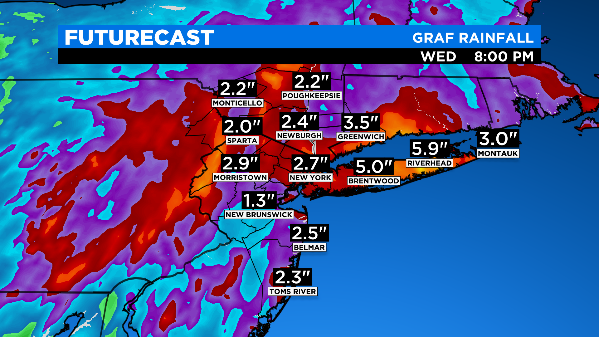
NEW YORK (CBSNewYork) — A rare October nor’easter is approaching the Tri-State Area with heavy rain and strong wind.
Monday 10/25
- 7 p.m. to midnight — Scattered showers and thunderstorms push through, potentially severe at times. Straight-line, damaging wind will be the main concern, as well as downpours that could cause flooding.
Tuesday 10/26
- Midnight to 6 a.m. — Coastal storm becomes more organized and produces widespread rainfall, some may be heavy at times. Flash floods will be possible during this period.
- 6 a.m. to 11 a.m. — Rain and periods of heavy rain continue to push through with flooding likely around the area.
- 11 a.m. to 5 p.m. — Rain and localized heavy rain is still possible. Blustery conditions expected as wind ramps up around the area.
- 5 p.m. to 2 a.m. — Rain gradually winds downs, while the wind continues to ramp up around the area. Wind gusts of 45 to 50 mph will be possible across Long Island.
Wednesday 10/27
- 2 a.m. to 8 a.m. — The last of the rain exits the area, but it remains blustery.

Click here for the latest forecast.
Flood safety tips, power outage links & more.
from CBS New York https://ift.tt/2Izr88c


